
BAMS: TP-River: Monitoring and Quantifying Total River Runoff from the Third Pole
DOI: https://doi.org/10.1175/BAMS-D-20-0207.1
Abstract
Monitoring changes in river runoff at the Third Pole (TP) is important because rivers in this region support millions of inhabitants in Asia and are very sensitive to climate change. Under the influence of climate change and intensified cryospheric melt, river runoff has changed markedly at the TP, with significant effects on the spatial and temporal water resource distribution that threaten water supply and food security for people living downstream. Despite some in situ observations and discharge estimates from state-of-the-art remote sensing technology, the total river runoff (TRR) for the TP has never been reliably quantified, and its response to climate change remains unclear. As part of the Chinese Academy of Sciences’ “Pan-Third Pole Environment Study for a Green Silk Road,” the TP-River project aims to construct a comprehensive runoff observation network at mountain outlets (where rivers leave the mountains and enter the plains) for 13 major rivers in the TP region, thereby enabling TRR to be accurately quantified. The project also integrates discharge estimates from remote sensing and cryosphere–hydrology modeling to investigate long-term changes in TRR and the relationship between the TRR variations and westerly/monsoon. Based on recent efforts, the project provides the first estimate (656 ± 23 billion m3) of annual TRR for the 13 TP rivers in 2018. The annual river runoff at the mountain outlets varies widely between the different TP rivers, ranging from 2 to 176 billion m3, with higher values mainly corresponding to rivers in the Indian monsoon domain, rather than in the westerly domain.
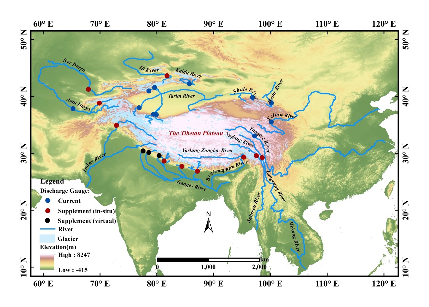
Fig. 1. Major rivers and the discharge gauges at mountain outlets (where rivers leave the mountains and enters the plains) in the Third Pole region (TP). “Current” and “Supplement” denote existing and newly built discharge gauges, respectively. The “virtual” station indicates no onsite measurement.
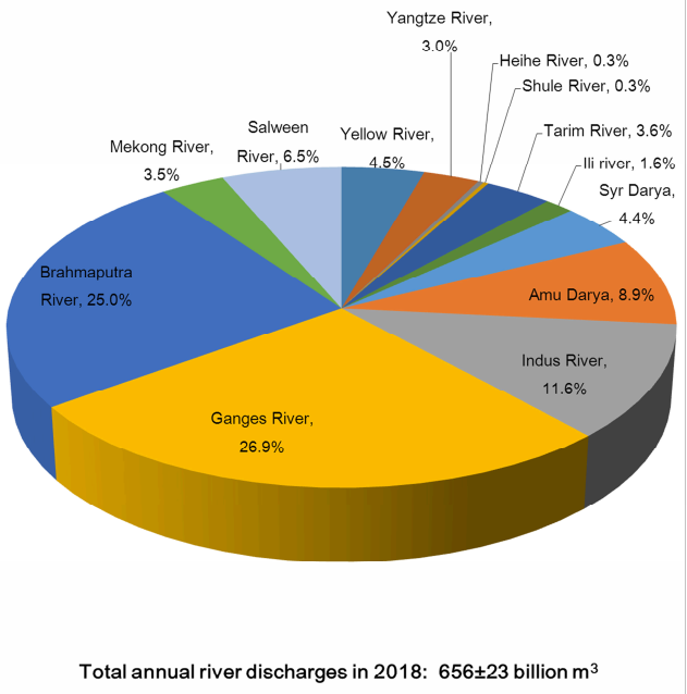
Fig. 6. Annual discharge at the mountain outlets for 13 major TP rivers in 2018. The estimated total river discharge from TP is 656 ± 23 billion m3 for 2018, based mostly on ground-based observations from existing or newly built discharge gauges.
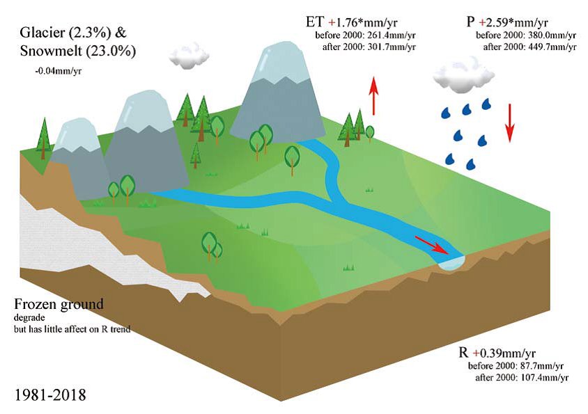
Fig. 5. A pilot cryosphere–hydrology modeling study to identify the driving forces behind the discharge change in the upper Yangtze River from 1981 to 2018. Here, significant increase in both precipitation (2.59 mm yr−1; p < 0.05) and evapotranspiration (1.76 mm yr−1; p < 0.01) has led to an insignificant increase in runoff (0.39 mm yr−1), showing an intensified basinwide hydrological cycle. Snow and glacier melt contributes a quarter to the total river discharge on average, but there is no prominent trend in the melting, while the frozen ground degradation exerts little influence on the runoff trend in recent decades.